Community Health & Climate Change Maps
VCH is using models and maps to advance our collective understanding of what makes individuals and communities vulnerable to climate change.
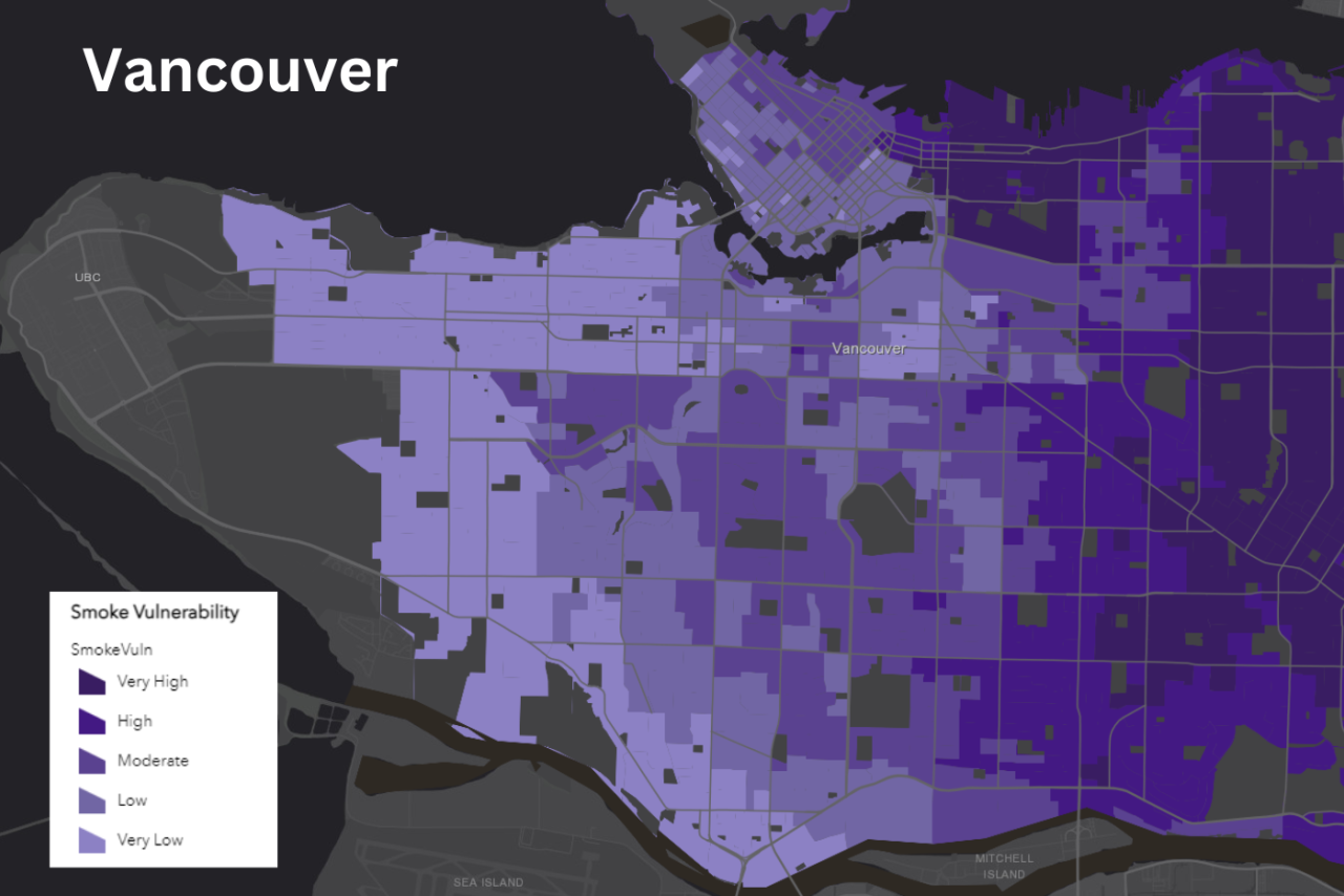
Working in partnership with researchers from the University of British Columbia, Vancouver Coastal Health and Fraser Health created a series of maps that represent the vulnerability of communities within our health regions to four climate hazards: heat, smoke, ozone, and flooding. These maps are meant to advance our collective understanding of what makes individuals and communities vulnerable to climate change.
The project's findings are available to the public and to program planners. View the interactive climate change and vulnerability maps.
Read the summary report of the climate change and health vulnerability mapping project.
